Sunken Monuments
8 entries
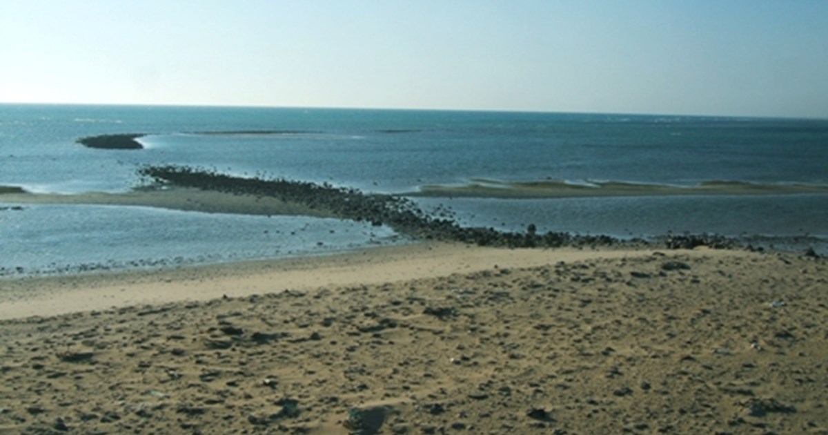
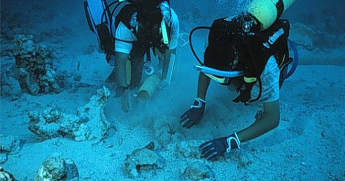
Wadi Al Jarf Port
2600 BC
The oldest submerged Harbor which located in red sea governorate dated to 2600 B.C - its construction approximately takes a form of LShape. The sea port consists of the remains of water installations in the form of the Latin letter L with a slightly spherical angle. Today, part of it appears on a small rocky head, then extends eastward to about 160 m and then extends irregularly to the south-east for about 130 m. The width of this building is between 8 m and 14 m and is deposited in water that does not exceed the depth - currently - two meters. It is likely that this building was constructed to serve as a barrier to the northern waves and currents to provide a large water area where ships can dock and depart safely. The water area occupied by the inland basin of the old port is estimated to be at least 5.67 ha. The site's function as a seaport is confirmed by the finding of 21 limestone anchors dating back to the 4th Dynasty, about 120 meters from the present beach and about 11 meters south of the wave barrier. There is no doubt that the discovery of the port, which dates back to the era of King Khufu, the most famous of the kings of the fourth family (about 2600 BC) in the location of the valley of the shelf is one of the most important scientific events in the modern era; because it contains the oldest facilities of the port known industrial so far in the world, This port is that the ancient Egyptians had experienced the establishment of sea ports since the fourth family at least, and formed a network between the Red Sea coast and the Sinai Peninsula.
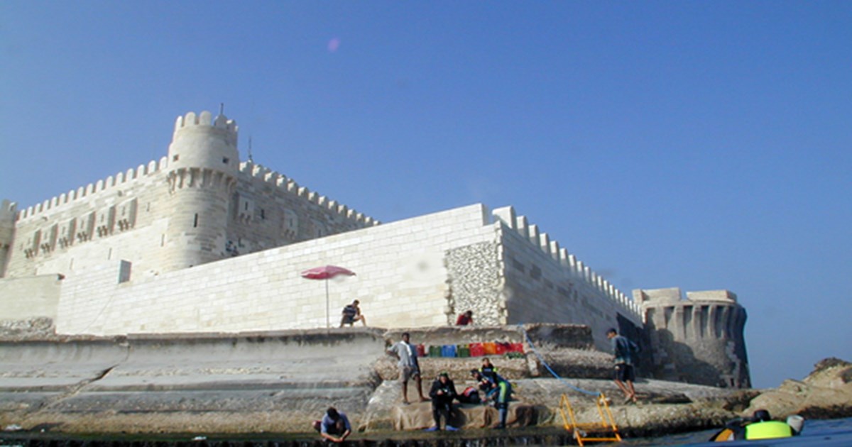
Qaitbay Fort site
The site is located in Alexandria, at the eastern tip of the Pharos Peninsula, facing the eastern side of the Qaitbay Citadel. The site begins directly at the edge of the citadel, extending for 150 meters, with a depth ranging from 6 to 8 meters. In 1962, Kamel Abu El-Saadat collaborated with the Egyptian Navy to recover the statue known at the time as the "Isis of Pharia." The statue was broken into three pieces, and it was discovered that the base retrieved belonged to the statue. As a result, it was decided to place it in the Maritime Museum of Alexandria's Center for Studies under the leadership of Dr. Jean-Yves Amberier. Work on the site began in 1994.The site contains the remains of artifacts that were once around the "Pompey's Pillar" and were thrown into the harbor during the reign of Saladin in 1167 to hinder the Crusader invasion from Cyprus. The site also includes debris from the Pharos lighthouse and its island, as most of the pieces weighing over 20 tons are arranged in a linear formation heading north, slightly away from the base of the citadel, confirming that they fell from a high or large structure. More than 3,000 architectural artifacts have been discovered (columns, statues, bases, capitals), with 36 large pieces selected and displayed in a corridor in the Roman Theater at Kom El-Dikka. Additionally, the wreckage of three ships has been identified, with only their cargo remaining. These artifacts date from the 3rd century BC to the 7th century AD.
Shatby
Submerged site has many pieces and architectural components and monuments where was located at the city's Royal Quarter and believed to contain remains of the Temple of ISIS. East of the Eastern Harbor of Alexandria, from Cape Silsileh to sidiBishr promontory. Most important discoveries: - Many site were discovered at El-Hassan reef,Chatby,Ibrahimieh,Sporting EL-Kour islets and BirMas’oud. - A large number of amphorae, concreted on the seabed, cover the El-Hassan reef and its contours marking the location of several shipwreck -Two sites were discovered in Shatby, and one is the sub-merged part of cape Silsileh that formed part of the Royal Ptolemaic quarters - 400 architectural elements of various stones lie on the seafloor - At Ibrahimieh, two sites have also been discovered. Some 50 small- and medium-size stone anchors dating to the Islamic period were raised from the first site that lies on a large reef at 13–15 m depth, 450 m from the shore. The second site lies in the shallows and consists of a large stone quarry, some shaft tombs as well as a complex grid of fish tanks. - At El-Dahab, El-Kour islets and BirMas’oud promontory demonstrated that these three sites and the submerged areas between them formed a large necropolis dating to the Graeco-Roman period. - -Numerous stone anchors and fishing tackle was found on the seabed north of El-Kour islet.
Mamoura Bay
The Mamoura Bay at Alexandria is a vast bay stretching from the royal Montaza gardens in the west to the gulf of Abu Qir in the east. The bay was the gateway to the ships coming from the Mediterranean on their way to the Nile. By hugging the coast of the bay, the ships traveled to the Canopic branch of the Nile and transported their goods to all of Egypt.Pottery sherds and amphorae were found scattered on the bay’s seabed, a testament to the many shipwrecks that took place here. The artifacts testify to the flourishing trade between Egypt and the world. A survey of the seabed revealed an ancient Roman shipwreck, remains of which are still present today. Little is known about Mamoura Bay, but excavations are gradually providing us with information on the area. A small port and paving dating to the Greco-Roman Period were found, along with the limestone quarry that was used to build them.Rock cut basins were also discovered and are thought to be evidence of fish farming, raising the possibility of a settlement that was once located here.
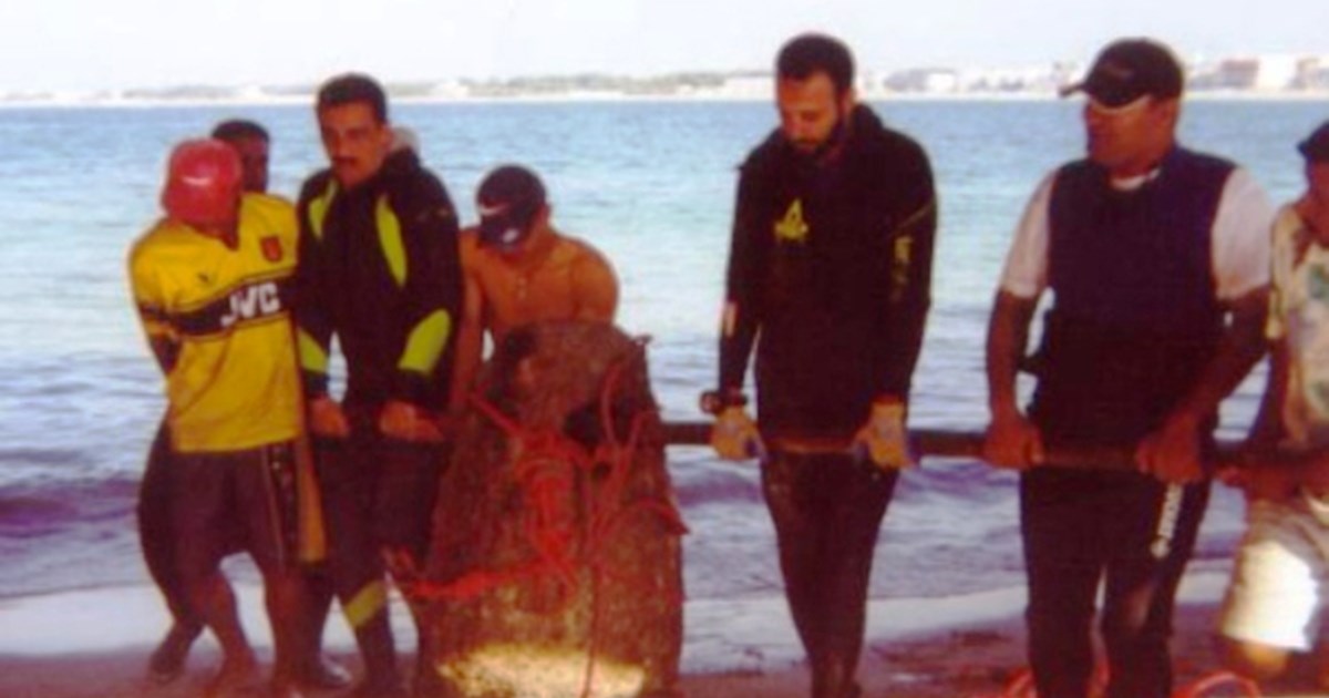
Saadana Island
Saadana Island, on the Red Sea coast north of Safaga in Red Sea governorate, is home to a shipwreck that offers us a rare glimpse into 18th Century trade. This area in the sea is difficult to navigate due to its shallow waters and multitude of corals, which is probably the reason the ship sank in the 1760’s. The ship was 50 meters long and was carrying about 900 tons of cargo. Excavations revealed that the ship was carrying Chinese Qing Dynasty porcelain that was fashioned for the Middle East. Many spices were also found aboard the ship including pepper, cardamom and nutmeg from India; frankincense from Oman; as well as, coconuts, olives and hazelnuts among other things. The ship does not resemble other ships from this period, and so its origin remains unknown. However, its contents shed light on the intensive and far reaching trade that occurred during this time, and Egypt’s ports as the link between the east and the west.
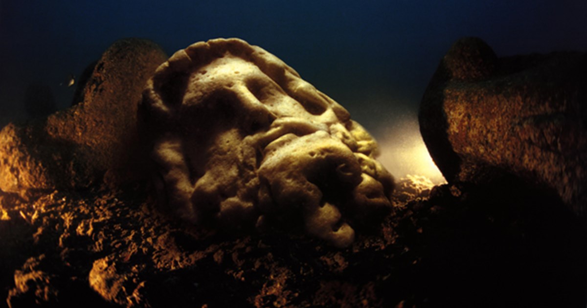
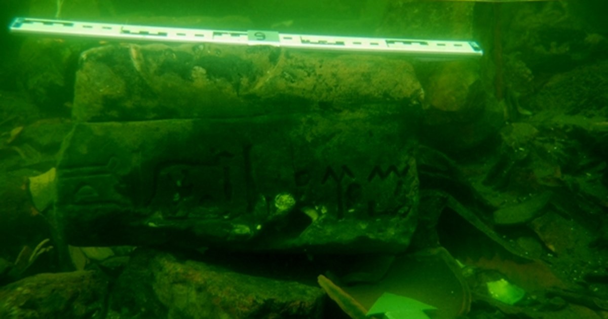
Eastern Harbor
The Eastern Harbour of Alexandria is the ancient royal port of the legendary city founded by Alexander the Great. Bearing his name, Alexandria rose to become one of the greatest metropolises of the ancient world—a global hub of politics, culture, and learning. It served as the capital of Ptolemaic Egypt and remained a preeminent city throughout the Roman and Byzantine eras. Today, this harbour, once the vibrant heart of royal and maritime life, lies submerged beneath the waters of the Mediterranean Sea.The harbour stretches from Ras el-silsila(Head of the chain) in the east to the iconic Qaitbay Citadel in the west, covering an extensive area of approximately 600 hectares. Lying at depths of 2 to 8 meters, its remains trace the ancient coastline of the city. Historical sources confirm this area was the prestigious Royal Quarter during the Ptolemaic dynasty, a status it maintained as the district of palaces and administration for Roman and Byzantine governors. it has been the focus of significant underwater archaeological discoveries since the mid-20th century.The modern exploration began in 1961 with Kamel Abou El-Saadat, a pioneering amateur diver and researcher of submerged antiquities. He discovered a colossal statue of the goddess Isis among other artifacts, identified the remains of ancient stone piers, and produced the first preliminary map of the sunken site. in 1992 the European Institute for Underwater Archaeology (IEASM), under the direction of Franck Goddio, conducted a comprehensive topographic survey using advanced archaeological scanning technology. This provided highly accurate data on the sunken port's structures. The mission's work revealed: The precise layout of the ancient Eastern Harbour and its subsidiary royal ports, identifying ten main harbors, including:The Grand Harbourk, The Inner Harbour and An additional small harbour, The exact contour of the ancient coastlineand long sea piers extending from the shore. A massive breakwaterthat stretched to the middle of the harbour. The locations of the famed island of Antirhodosand the peninsula of the Timonium.These discoveries include what are believed to be the ruins of a royal palace, a theater, and a temple dedicated to Poseidon, offering a tangible connection to the splendour of ancient Alexandria. This sunken royal quarter stands as one of the world's most fascinating underwater archaeological sites, providing invaluable insights for academics and a breathtaking glimpse into the past for visitors and tourists from around the globe.
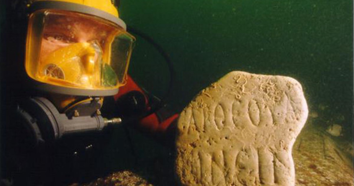
Abu Qir Bay
A Sunken Treasure of History Abu Qir Bay is a marine bay located about 22 km east of Alexandria’s territorial borders. This area gained historical significance in 1859 when Prince Omar Touson, with the help of local fishermen and divers, identified the remains of massive ancient structures underwater. In 1961, Kamel Aboul-Saadat documented numerous archaeological artifacts and shipwrecks in the bay, marking their locations on a preliminary map submitted to the Graeco-Roman Museum. However, no further exploration took place until 1985, when a French team led by lawyer Jacques Dumas attempted to locate the wreckage of Napoleon’s fleet. With Aboul-Saadat’s assistance, they mapped several sunken ships, including: L’Orient (Napoleon’s flagship, which exploded in battle) La Sérieuse and Le Guerrier (two other warships) The team recovered weapons, ammunition, daily life objects, coins, and navigation tools from the wrecks. Unfortunately, the expedition was halted after Dumas’ sudden death. Rediscovery in the 1990s In 1996, the European Institute for Underwater Archaeology (IEASM), led by Franck Goddio, resumed exploration using advanced sonar and magnetic scanning technology. They created detailed maps of: Napoleon’s sunken fleet (6 warships). The lost cities of Thonis-Heracleion and Canopus. The Sunken Cities Canopus (East Canopus) Located 2 km north of Abu Qir’s shore, at a depth of 4–5 meters. An ancient religious and trade center linked to Egyptian and Greek gods. Thonis-Heracleion Discovered 6 km north east of Abu Qir, submerged under 5–7 meters of water. Once a major port city before Alexandria, it vanished due to earthquakes and rising sea levels. Treasures Found Coins from Mediterranean countries visited by Napoleon’s fleet. Statues, temples, and weapons from Pharaonic, Greek, and Roman eras. Why Is Abu Qir Bay Important? Napoleonic Wars: The 1798 Battle of the Nile (Abu Qir Bay) was a key naval conflict where Nelson defeated Napoleon’s fleet. Ancient Mysteries: The sunken cities reveal Egypt’s lost connections to Greek and Roman civilizations.
Aswan
During ancient times, the Nile was the primary mode of transportation in Egypt. Massive stones were transported on ships from quarries in the south intended for tombs, temples and other monuments in the north. Aswan had two quarries that were extensively used; granite was brought from Aswan, and sandstone from Gebel El Silsila. The journey undertaken by the ships carrying such heavy loads was not always successful, and some sunk in the Nile. In addition, some massive stones fell during their transfer onto the ships and now lie in the river’s depths. A quay for the transport of the heavy stones has been identified at Elephantine, called El -Ahly Quay, and is believed to have been one of the primary quays used. A smaller quay was also found at El Naga El Bahari.